

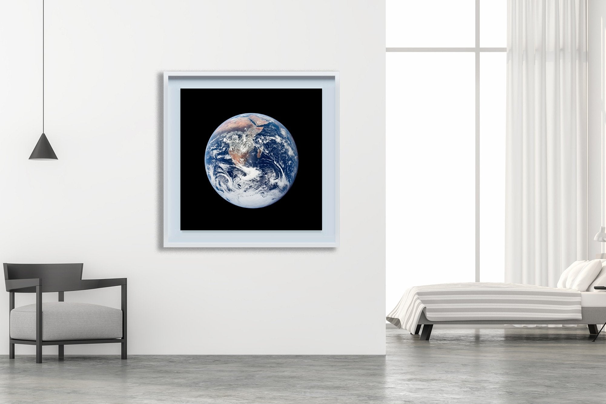

Earth - Apollo 17
$145.00
This view of Earth was seen by the Apollo 17 crew as they traveled toward the moon on their NASA lunar landing mission. This outstanding trans-lunar coast photograph extends from the Mediterranean Sea area to the Antarctica south polar ice cap. This is the first time the Apollo trajectory made it possible to photograph the south polar ice cap. Note the heavy cloud cover in the Southern Hemisphere. Almost the entire coastline of Africa is clearly visible. The Arabian Peninsula can be seen at the northeastern edge of Africa.
The large island off the coast of Africa is the Malagasy Republic. The Asian mainland is on the horizon toward the northeast. The Apollo 17 crew consisted of astronauts Eugene A. Cernan, mission commander; Ronald E. Evans, command module pilot; and Harrison H. Schmitt, lunar module pilot. While astronauts Cernan and Schmitt descended in the Lunar Module (LM) to explore the moon, astronaut Evans remained with the Command and Service Modules (CSM) in lunar orbit.
The National Aeronautics and Space Administration (NASA) is an independent agency of the United States Federal Government responsible for the civilian space program, as well as aeronautics and aerospace research.
The Apollo program, also known as Project Apollo, was the third United States human spaceflight program carried out by the National Aeronautics and Space Administration, which succeeded in landing the first humans on the Moon from 1969 to 1972.
PS : Note that those artworks are not printed in Limited Edition.
Related Items


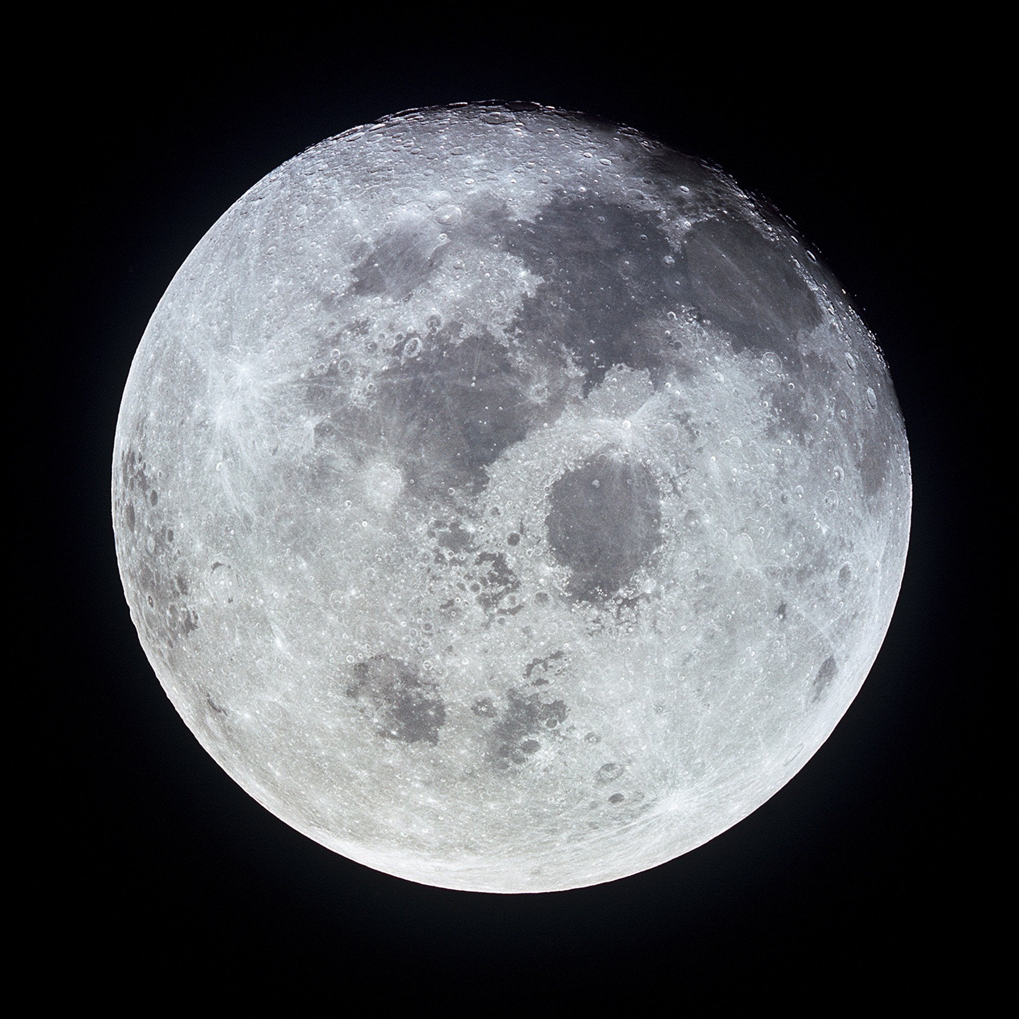

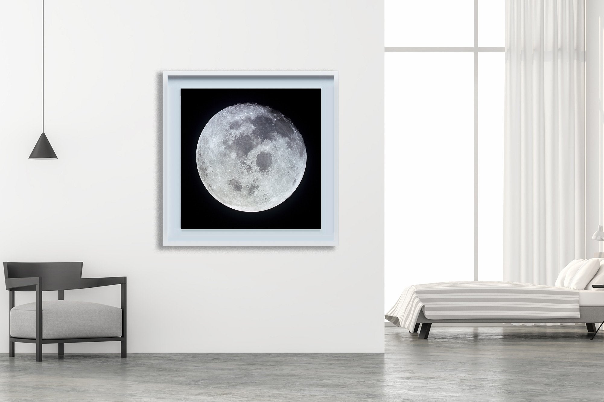

Full Moon - Apollo 11
$145.00
This outstanding view of the whole full moon was photographed from the Apollo 11 spacecraft during its trans-Earth journey homeward. When this picture was taken, the spacecraft was already 10,000...
View full product details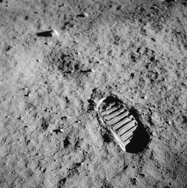
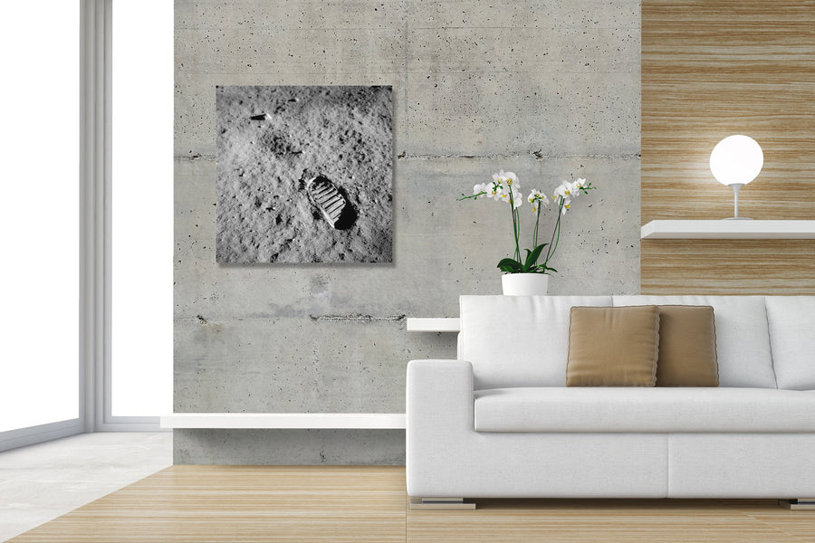

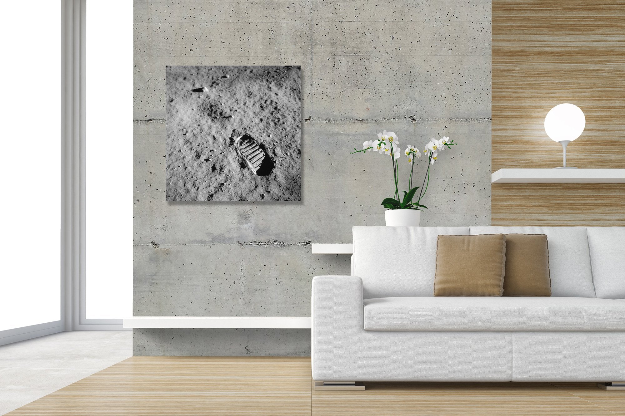
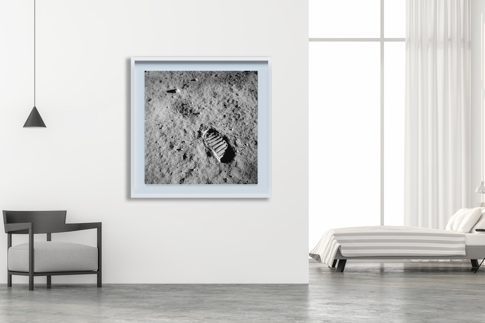
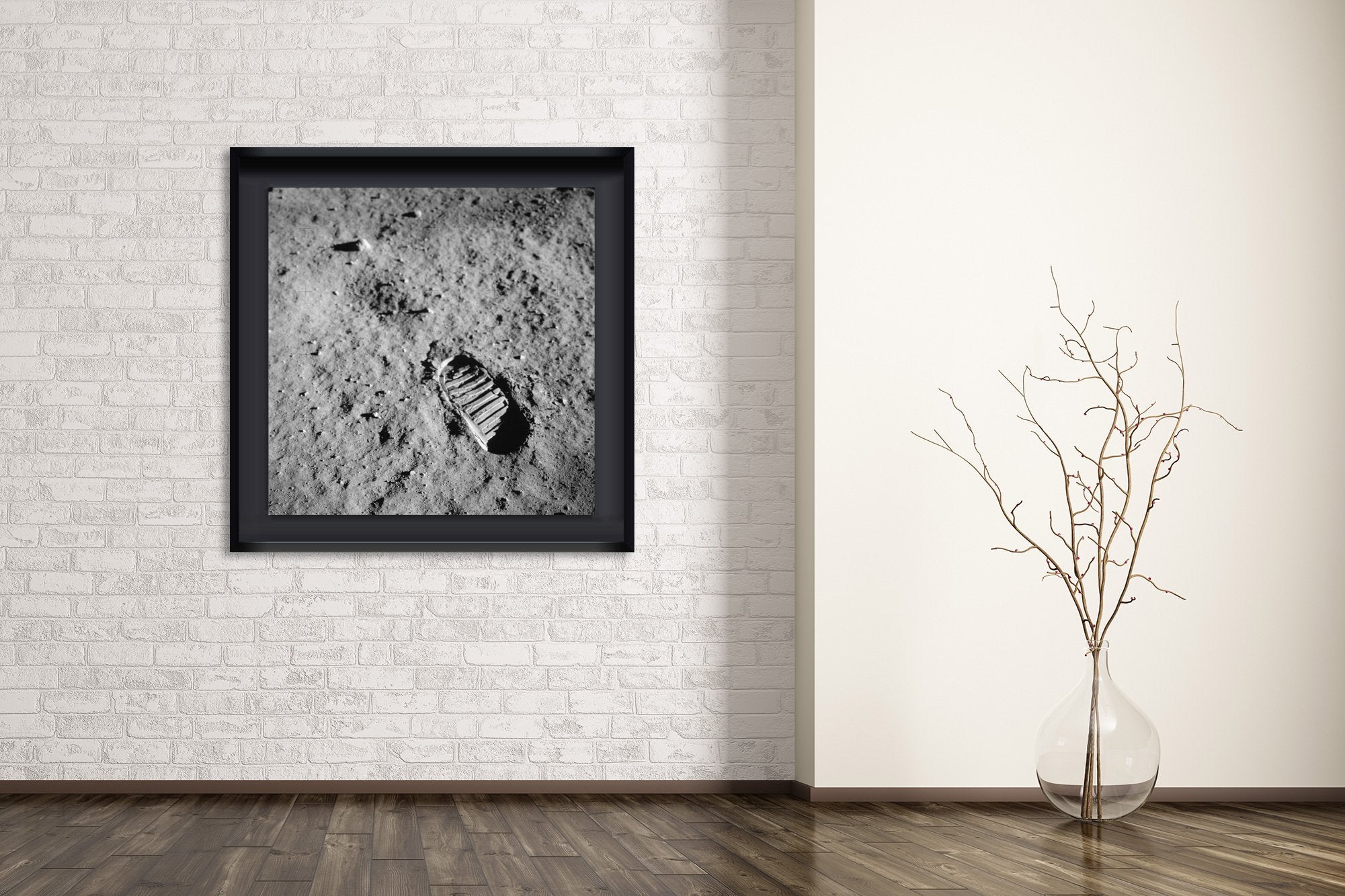
Footprint - Apollo 11
$145.00
A close-up view of an astronaut's bootprint in the lunar soil, photographed with a 70mm lunar surface camera during the Apollo 11 extravehicular activity (EVA) on the moon. While astronauts...
View full product details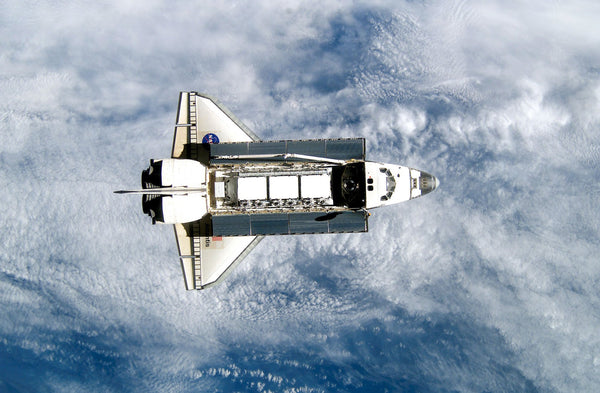


SS Atlantis
$145.00
Midmorning proved the perfect time for a Space Shuttle launch as the thunderstorms that characteristically develop later in the day during hot Florida summers held off long enough to allow...
View full product details


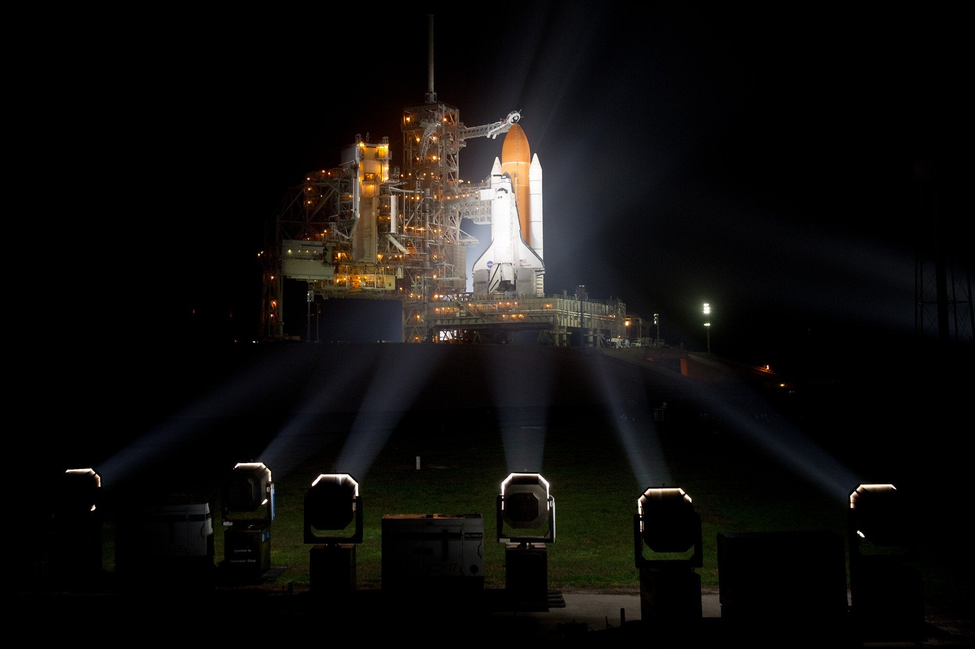
Shuttle ready to Launch
$145.00
The space shuttle Discovery is seen shortly after the Rotating Service Structure was rolled back at launch pad 39A, at the Kennedy Space Center in Cape Canaveral, Florida, on Wednesday,...
View full product details